 UPDATED: June 21, 2:00 AM
Note: The next update will be around the morning before noon. CLICK ON THE IMAGES TO SEE THEM CLEARLY.
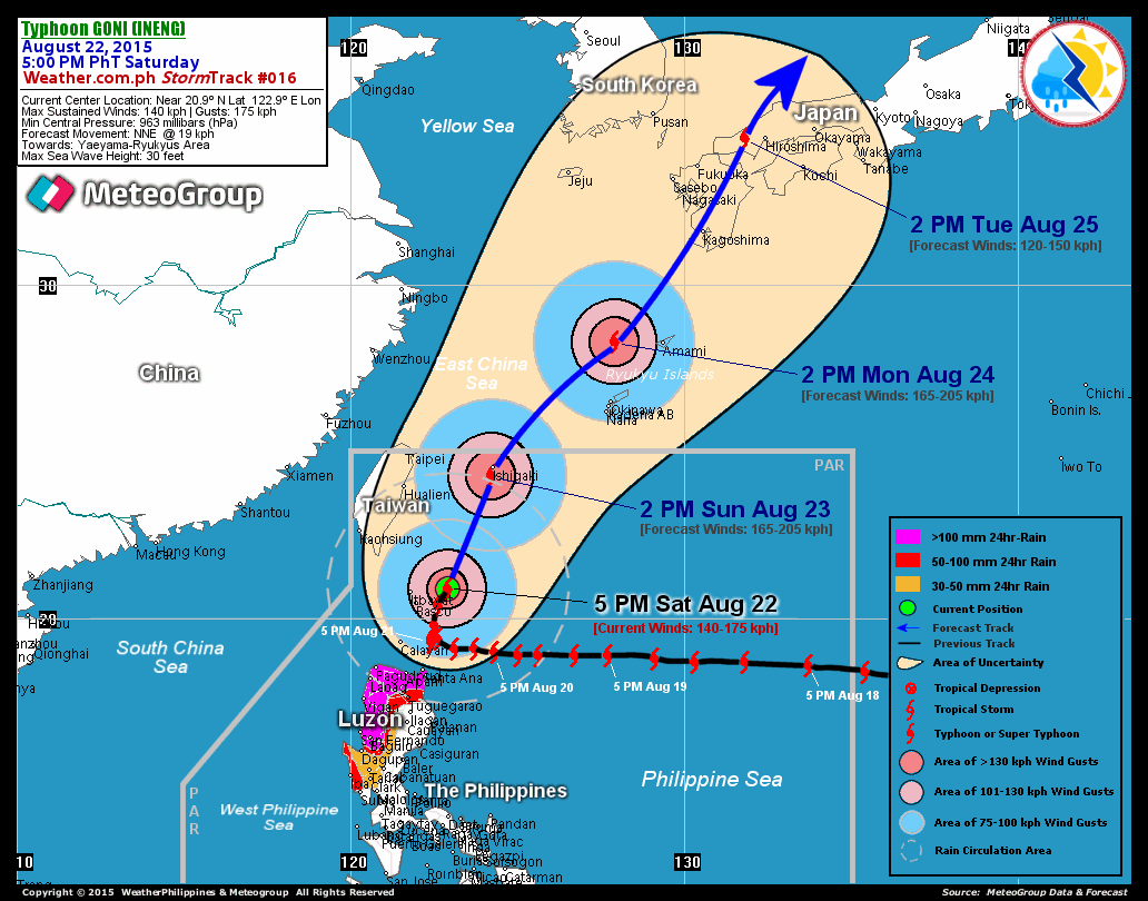
PAGASA's 11PM forecast yesterday declared that the EYE of typhoon Frank is expected to cross Southern Luzon including the CITY OF LUCENA tomorrow afternoon, pouring its MAXIMUM STRENGTH over the inland waters of Southern Quezon, off to the aforementioned city and eventually the provinces east of Metro Manila.
Frank maintaned its strength to 140 km/h and gustiness of 170 km/h near the center. It is moving at a speed of 19 km/hr and is expected to be in Lucena by 12 noon today. By midnight, Frank would have crossed Manila and would be heading towards the provinces of Northern Luzon. As forecasts of international weather beaureus claim, residents of southern tagalog region and western parts of the eastern Bicol region are expected to feel the most extreme possible winds and rains of Frank as it crosses the islands toward Metro Manila or, otherwise, Northern Luzon..
The Philippine weather bureau hoisted the provinces of Southern Quezon, Bicol Region, and Metro Manila to SIGNAL NUMBER 3 for the provincial disaster coordinating councils of the respective provinces to initially prepare for the most likely track of the typhoon. [for the updated typhoon warning, visit this website: http://www.pagasa.dost.gov.ph/wb/wb.html]
The now-considered "most likely" track is contrasting to the previous forecasts where the typhoon, which made landfall in Eastern Samar, June 20, had been expected to pass the eastern ridge of the archipelago proceeding towards Taiwan and Southern Japan.
Meanwhile, PAGASA mentions that they are still looking for signs on the possibilities for a second scenario of the track of the typhoon, which could otherwise trail the track of Southern Quezon toward Northern Palawan or Mindoro provinces, instead of Metro Manila and Northern Luzon.
For more infos, plese see the following links:
http://www.pagasa.dost.gov.ph/
http://www.typhoon2000.ph/
http://en.wikipedia.org/wiki/2008_Pacific_Typhoon_Season
NOTE: This news item and update is restrictive only tothe Southern Tagalog Region. Once the region is officially free from the typhoon, only then will the updates be stopped.
International Forecasts were also considered and analyzed.
DISCLAIMER: The forecast on this weather bulletin may not be COMPLETELY concrete since details were gathered and analyzed through different weather bureaus. Images posted here were taken from websites of the different weather bureaus which freely allows online surferes to be accessed. If this be found illegal, I would be happy to be notified so that I could remove them quickly.
Friday, June 20, 2008
Typhoon Frank to hit LUCENA and MANILA
Subscribe to:
Post Comments (Atom)


0 comments:
Post a Comment